Darley Abbey Heritage Walks
Discover Darley Abbey
Darley Abbey Heritage Walks
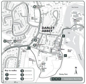
Five short heritage walks in Darley Abbey, set out below, or available to download as a pdf here:
Darley Abbey Heritage Walks leaflet
Discover Darley Abbey, one of the key communities within the Derwent Valley Mills World Heritage Site. It was here, in an area previously known for its abbey and later water-mills, that Thomas Evans and his sons William and Walter harnessed the power of the Derwent to power their cotton mill complex, now one of the most complete early cotton factory sites surviving in the world. To house the mill workers an industrial community was created on the opposite bank, incorporating earlier buildings.
In recognition of their significance to world history, the mill complex and housing are now part of the Derwent Valley Mills World Heritage Site, inscribed by UNESCO in 2001, and which also includes mills and communities at Matlock Bath, Cromford, Belper, Milford and Derby.
The name Darley Abbey relates to the prosperous Augustinian Abbey of St Mary, of which little remains.
In 1750 two unrelated Evans families merged with the marriage of Thomas Evans of Bonsall and Sarah Evans, daughter of Alderman William Evans, originally of Draycott. Alderman William Evans owned various mills in Darley Abbey, butit was through the efforts of Thomas and his sons that the cotton mills and community we see today were financed and built. Subsequently, the Evans family of Darley Abbey and another family of cotton mill pioneers, the Strutts of Belper, were linked by marriages in 1785 and 1793. William Evans married Elizabeth Strutt in 1785, and in 1793, William’s sister Barbara Evans married Elizabeth’s brother, William Strutt.
Walk 1 (0.5 miles): The Boar’s Head Cotton Mills
These are among the most complete of any of the early cotton factory sites. The Evans mills were famous for their high quality thread that was identified by the trademark of a Boar’s Head, the crest on the family coat-of-arms.
While standing in front of the Interpretation Board ‘A’ you can see the weirs that created the head of water required to power the mills. The weirs have lost their sluice gates and the associated control equipment and have been reduced in height. Beyond the river is the mill complex, which can be visited by crossing the bridge.
Please note that the bridge and the mill complex are privately owned and visitors should take great care when walking through the mills– vehicles regularly use the roads between buildings and as an access road through the mills. Visitors are advised that there is no access to the mill buildings except on authorised business.
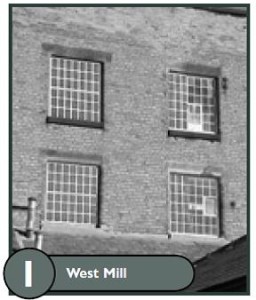
After crossing the bridge the first tall building on the right is the four-storey West Mill (1821), a mill constructed using advanced cast iron structural techniques – note the ‘tromp l’oeil’ windows painted on the wall of this building carefully added to visually ‘balance’ the building when seen from a distance.
Beyond is the five-storey Long Mill (1782/8), the oldest building on the site, taking six years to become fully operational. In 1789 it burnt down and was rebuilt and in use again in 1790 – the top floor was used as a schoolroom to provide child workers with the basic education needed to be effective in the mills.
Continuing beyond the Long Mill, you pass between two low stone walls that formed the bridge over the water course feeding water to the water wheels (Head Race). To your right is the five-storey Middle Mill (1804/5) and connected to it the East Mill (1811).
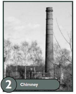
Still on the right hand side there are many ancillary buildings and the remains of a Free Standing Chimney, part of the long-demolished boiler house for providing the mills with steam power.
Turn round and retrace your steps. The long low building on your right was the Gassing Shed (c1862), where cotton thread was passed at high speed through a gas flame to smooth the thread by burning off any stray fibres. Behind this building is the three-storey North Mill (c1835).
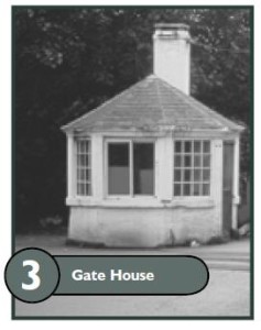
As you return to the bridge you pass the small Gatehouse that controlled the flow of workers, raw materials and finished goods in and out of the site. Re-cross the bridge back to Interpretation Board ‘A’.
Walk 2 (0.6 miles) – The Mill Village and Darley Park
At Interpretation Board ‘A’, turn your back on the Mills and proceed to the end of the riverside gardens which is the start of Darley Street. On the right hand side is The Square (1792), known to the locals as Flat Square, a U-shaped configuration of three-storey terraced mill cottages built for the mill workers. The other houses on the right were also workers’ cottages, the two-storey buildings being older than the others.
Moving along the street, on the left hand side you will pass an old industrial building that was associated with industry in the village before the arrival of the cotton mills. On the right there is The Abbey public house, a recent use of a mediaeval building, the only substantial remains of the era of the long lost Augustinian Abbey. Behind The Abbey is Hill Square, another group of mill cottages. Opposite The Abbey turn left, in front of you is Dean’s Field. To your right is a building that is now The Royal British Legion but was once the Church Room – note the interesting plaque on the wall facing Darley Street!
Now go on to Dean’s Field where you will find Interpretation Board ‘C’. After reading the board, turn left to face the open park land – this is Darley Park once the parklands associated with Darley Hall, the home of the Evans family from 1835. Every summer the park is the location of free open air concerts with spectacular fireworks displays. Follow the footpath into the park and bear to the right following the edge of the gardens containing a fine collection of specimen trees and shrubs.
At the top of the slope there is a road that leads through the park. Turn to the right towards the Terrace Café which is located in the only remaining part of Darley Hall – it was once the Billiard Room. Darley Hall was demolished in 1962, the outline of the Terrace being the outline of the Hall. Beyond the café the road splits, take the right-hand turn under the archway to visit the Stable Yard and return to the fork.
Bear to the right. The road passes some of the remaining gardens that were part of the Evans estate. It is worth making a detour to view the Gardens, especially as they house part of the National Hydrangea Collection – take the steps that lead to the left off the road.
After visiting the gardens continue along the road towards Darley Abbey Village going through the Park Gates, to the left of which is located Interpretation Board ‘B’.
Walk 3 (0.25 miles) – ‘Up Darley’
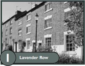
Turn left into Mileash Lane and ascend the hill. On the opposite side of the lane are mill workers’ cottages built from 1792. Further up the hill is a long stepped terrace of three-storey cottages (1795/96). Running behind this row is another stepped terrace on Lavender Row (c1820/30s), that is more elaborate than the Mileash Lane terrace.
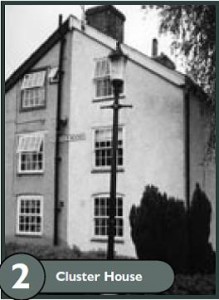
At the junction of Mileash Lane and Lavender Row is a free standing group of houses called The Four Houses (1792). This house type is called a Cluster House and these are reputedly the earliest known example of this style of housing – four individual houses built together.
Descending the hill you pass in front of a terrace of two-storey cottages (c1871) set back from the Lane with individual front gardens. These were the last of the Evans-built workers’ terraces.
The last historic building you pass is Elm Cottage (c1882), a superior detached building that was the Estate Office.
Return to Interpretation Board ‘B’ to continue the other Darley Village walks.
Walk 4 (0.5 miles) – ‘The Church’
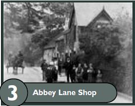
Stand with your back to Interpretation Board ‘B’, now proceed straight ahead along Abbey Lane – locally this was known as Shop Row.
On your right you pass the Village Shop – the shop has been part of the scene since the development of the mill village and always seems to have been privately owned.
Adjacent to the shop are old stone buildings that may incorporate walls of the ‘lost’ Abbey. Opposite are old cottages that were part of the village before the workers’ cottages were built.
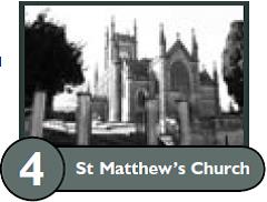
As you reach the junction of Abbey Lane and Old Lane you will see St Matthew’s Church (1819) on the hill on the left. At this point Abbey Lane becomes Church Lane, a confusing village quirk!
Continue up Church Lane until you see the steps to the church on the other side of the road – cross carefully and enter the churchyard. Ahead is the church that was the Evans family church and the villagers’ church. Some of the Evans family have graves in the graveyard and within the church itself is a crypt that contains the remains of nine members of the Evans family.
In the graveyard workers’ graves are identified by a slate tablet, some of which are now located by the Fellowship Room to the left of the church.
Return to the village through the graveyard passing the War Memorial, turning left at the bottom to exit onto the Church Lane/Abbey Lane junction. Again, carefully cross the road and retrace your steps back to Interpretation Board ‘B’.
Walk 5 (0.4 miles) – ‘Down Darley’
For the last walk turn right, downhill along New Road. Pause at the first turn to the left, Brick Row. To your right on New Road there are two impressive detached houses set in their own grounds, which were known as the Managers’ Houses – The Hollies (1803/06) and The White House (c1820).
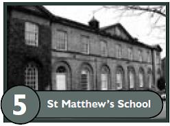
Turn into Brick Row. The imposing building on the left is the old St Matthew’s School (1826). The left-hand wing was accommodation for the Schoolmaster and at the other end was accommodation for the Schoolmistress.
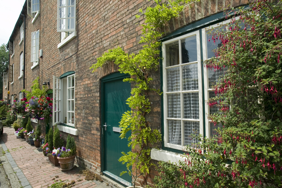
The three-storey cottages were built in two phases, (1797/98 and 1798/1800), using bricks made from the local brickyard. Like many Evans houses party walls were moved to alter the size of the family – evidence of such walls can still be seen across some of the top floor windows.
Return to the New Road Junction, turn left and descend into the village. On your right are two blocks of very imposing white two-storey houses – these are two, four-house ‘Clusters’ (1826). The houses are imposing because they could be seen from Darley House, one of the Evans family houses. On the land opposite these houses was an area of allotments available for mill workers to grow their own vegetables – the Methodist Church now stands on part of these allotments.
Further down the hill on the right are two, three-storey ‘Clusters’ (1826).
You are now near the end of the walk. Proceed downhill and turn left off New Road onto The Hill and on to West Row passing many more mill cottages. At the end of West Row on the left is a line of single-storey buildings – these were the privies (wash-houses) associated with the terrace of cottages opposite. This terrace forms the rear of The Square (Flat Square) first visited at the start of this village walk. Turn right from West Row and ahead you will see the river and mills where your walks started.
